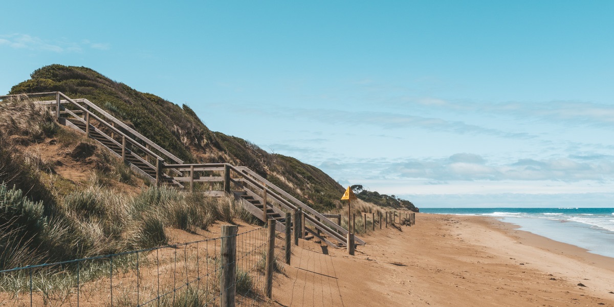
Coastal Erosion
 Climate change / Rising sea levels / Coastal erosion
Coasts are dynamic environments impacted by storms that are increasing in severity and frequency due to climate change. In some locations along the Great Ocean Road, this erosion is occurring at a fast rate and is impacting important community assets and infrastructure.
To plan for and mitigate these impacts, the Authority is working closely with the Department of Environment, Land, Water and Planning (DELWP) to develop and implement Coastal Adaptation Plans for the Great Ocean Road coastline.
These plans will identify short and long-term options for the Authority to manage the impacts and protect foreshores, Crown land and critical infrastructure from storm surge, wave attack and rising sea levels.
Background
Accounting for sea level rises in our planning laws
For the past 10 years, the Victorian Government has applied a consistent approach to planning for sea level rise and climate change impact to plan for possible sea level rise of no less than 0.8 meters by 2100. When assessing risk and coastal impacts associated with climate change this allows for the combined effects of tides, storm surges, coastal processes and local conditions such as topography and geology.
This is embedded in the Victorian Planning Policy Framework and councils are required to address how developments near coastal areas consider these factors and meet the relevant requirements.
Marine and Coastal Policy and Strategy
The Victorian Marine and Coastal Policy guides decision makers in the planning, management and sustainable use of our coastal and marine environment. It provides direction to decision makers including local councils and land managers on a range of issues such as dealing with the impacts of climate change, population growth and ageing coastal structures.
The Policy will be implemented through the development of a Marine and Coastal Strategy. The strategy will give effect to the policy by detailing priority actions over a five-year period and will be the key mechanism for addressing new and challenging issues. The strategy aims to improve coastal habitats and help coastal communities prepare and adapt to the impacts of climate change. It guides sustainable use and development and helps to identify the resources and funding needed to sustainably manage the environment.
The associated Marine Spatial Planning Framework also guides long term planning and management of Victoria’s marine environment in an integrated and coordinated way.
For more information visit: https://www.marineandcoasts.vic.gov.au/coastal-management/marine-and-coastal-policy.
Climate change adaptation action plans
The climate change adaptation action plans respond to and plan for the risks of climate change across seven sectors: the built environment, natural environment, water cycle, transport, primary production, health and human services, and education and training.
The plans are developed using the best available information including local sea level rise estimates and coastal hazards assessments as well as the latest climate and global sea level rise projections from the most recent Intergovernmental Panel on Climate Change (IPPC) report.
The draft Adaptation Action Plan for Built Environments proposes support for local councils so that planning schemes contain the best available information on climate change risks, including flooding and sea level rise.
The adaptation action plans will be finalised later in 2021 and updated every five years on a path to a climate-resilient Victoria in 2050.
Great Ocean Road Coast and Parks Authority Programs of Work
North Lorne erosion protection works
In January 2022, heavy rain resulted in overland water flow across the Great Ocean Road, eroding the dune embankment at the Three Pines car park in north Lorne.
The erosion damaged a pathway between the car park and beach. The pathway was temporarily closed for public safety while emergency repairs were completed.
Emergency works included:
- Drainage bars reinstated on the coastal side of the car park
- Drains on the inland side of the road checked and cleared in partnership with Surf Coast Shire Council
- Approximately 2 square metres of clay material installed
- Geotextile and agriculture pipe drainage installed to manage moderate rainfall events.
Following completion of these works in February 2022, the pathway was reopened. The emergency measures continue to work effectively in high rainfall events.
As part of these works, a Coastal Hazard Investigation was initiated for the north Lorne foreshore to address ongoing erosion in the area from coastal processes and overland water flow.
Community values will inform the Coastal Hazard Investigation. In September 2022, we ran a series of engagement opportunities to identified community values of the North Lorne foreshore, please find the What We Heard report below.
The Coastal Hazard Investigation report is expected to be completed by December 2022. The study will look at the coastline area between the Erskine River and the Three Pines car park.
In all our works, immediate risks to public safety must be ensured while using evidence-based planning for long-term solutions. These methods take time, to ensure unintended impacts are not caused elsewhere. Long term works require technical assessments and further consent under the Marine and Coastal Act 2018.
Wye River coastal erosion works
The river mouth at Wye River has slowly migrated eastward since 2019, resulting in substantial erosion of the eastern foreshore with up to 15 metres of landward recession observed over the last two years.
This coastal erosion negatively impacted beach access infrastructure and was threatening the Wye River Surf Life Saving Club in Winter 2021. The affected assets sit on a dune system that is a dynamic environment and naturally displays cycles of erosion and accretion.
Our team worked closely with the relevant authorities to deliver short-term actions that removed the immediate risk to the dunes in front of the surf club. This work included placing several rows of large sand bags along the dune system and installing three sand bag groynes on the beach to retain sand and keep the estuary from shifting east and eroding the dunes. Following the installation of the groynes, the river mouth migrated westwards and away from the Surf Life Saving Club and a significant amount of sand has since built up in front of the club.
A Coastal Adaptation Plan is currently being developed for the site. This will identify which dominant processes are influencing the estuary opening and movements at Wye River and recommend possible measures to address the issues.
Work to manage coastal erosion at Wye River will continue as a priority. A new beach access ramp was installed in October 2021, replacing the existing ramp that was damaged by erosion. The new ramp has a removable design and allows for simple removal and installation if relocation is needed. The new ramp material allows sand and water to flow through, reducing the impact on coastal processes.
For more information on the short-term actions that have been completed and the Coastal Adaptation Plan underway investigating longer term options visit: https://www.marineandcoasts.vic.gov.au/coastal-programs/coastal-adaptation-plans.
Apollo Bay coastal erosion works
Work is underway by DELWP on two new groynes to manage the impacts of beach and foreshore erosion at Apollo Bay.
Stage one of the project in February 2021 and is now complete. It included constructing two new 70-meter-long groynes and sections of rock seawall to protect the dune, walking path, cypress trees and Great Ocean Road.
Stage two of the $7.4 million project includes:
- approximately 600 metres of new rock seawall along the foreshore north of Milford Street
- a 160-meter-long rock seawall between the two groynes constructed during stage one
- a third 70-meter groyne just north of Mariners Lookout Road revegetation, new pedestrian stairways and maintenance vehicle access ramps.
For more details visit: https://www.marineandcoasts.vic.gov.au/coastal-programs/apollo-bay-and-marengo
Jan Juc Surf Life Saving Club coastal erosion works
Sand scraping and repair works were completed by the Authority at the Jan Juc Surf Life Saving Club in September 2021. These works have restored an access ramp that was eroded during winter rainfall, swell and high tides.
Works were conducted in consultation with the Jan Juc Surf Life Saving Club, Life Saving Victoria, DELWP and Corangamite Catchment Management Authority and are supported by longer-term strategies for addressing erosion.
Eastern View coastal erosion works
Sections of Eastern View have experienced high levels of erosion and action is required to avoid further damage to localised infrastructure, habitat and improve beach amenity.
In partnership with DELWP, the Authority is developing the Eastern View Coastal Adaptation Plan to investigate short and longer-term solutions to coastal hazards between Devil’s Elbow to Coalmine Creek (Memorial Arch).
Adaptation options to coastal hazards will seek to understand current community usage, and how coastal processes will affect the site under a changing climate.
Following recent erosion events at Spout Creek, the car park and access ramp have been temporarily closed for the safety of visitors.
These will reopen once it is again safe to do so. In the meantime, alternative beach access is available approximately 300-meters towards Moggs Creek.
Surf Coast Walk reroute at Aireys Inlet
Following a cliff collapse risk identified at Aireys Inlet as part of a geotechnical assessment, a section of the Surf Coast Walk in Aireys Inlet was temporarily closed in 2020.
The Authority led an investigation with engineers to find a safer alternative which also minimised damage to the local environment. Construction and reopening of the new clifftop route was completed by the Authority in mid-2021.
Demons Bluff beach closure in partnership with Parks Victoria and the Department of Environment, Land, Water and Planning (DELWP)
Following the identification of a large tension crack in the cliff top at Demons Bluff in Anglesea, the Authority formed a collaborative working group with DELWP and Parks Victoria to better understand the risk associated with this section of cliff. The working group has taken the following actions:
- A geotechnical risk assessment was commissioned which showed that the risk to life of beach users was unacceptable
- Following receipt of the risk assessment, a decision was made to temporarily close the beach until a long-term risk management approach to reduce the risk to a tolerable level could be adopted
- The following long-term management options were investigated:
- Managed removal: Removal of cliffs that exhibit tension cracks using explosives or mechanical methods
- Cliff stabilisation: The use of engineering techniques to stabilise the cliff face so that it does not fail or fail over the beach to the same extent
- An exclusion zone: Installation of a barrier to stop people accessing the hazard zone below the cliff
- Permanent beach closure.
A permanent beach closure was considered the most appropriate course of action to take at this site. This decision was based on the significant public safety risks landslides pose along this section of cliffed coastline.
An exclusion zone has been set from 100-metres north of the Anglesea Family Caravan Park beach access ramp to 300-metres past Grinders Point. Permanent signage will be installed onsite to inform users of the exclusion zone and our team has installed fencing along the cliff top and delivered revegetation programs to help reduce the risk to the public in these areas.
Along with DELWP and Parks Victoria, we continue to monitor the cliffs and undertake geotechnical studies in the area to investigate permanent risk management options. A range of ongoing management actions will continue in order to control the cliff risk at this site.
Coastal Monitoring Program
As part of our Coastal Monitoring Program, we regularly capture photo observations, undertake post-storm erosion assessments and complete drone surveys across the Great Ocean Road coastline.
The drone surveys undertaken as part of this program have provided data to help inform management decisions at Wye River and Eastern View, where coastal hazards are predicted to increase due to climate change.
If you would like to hear more about any of the above Coastal Erosion Projects please send us an email to info@greatoceanroadauthority.vic.gov.au.